Reading the Flatirons: Landscape, Recreation, and Boulder’s Sense of Place
Contemporary independent editorial essay. This is not a recovered article from the historic Boulder Magazine. Editorial note: Dates and institutional descriptions in this essay are attributed to linked sources. Readers should check current visitor information and original records before relying on operational details or interpreting historical materials as complete.
A landscape that works as a landmark
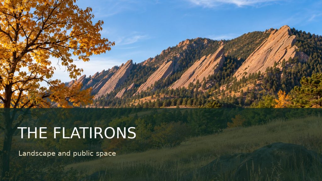
The Flatirons are visible from many parts of Boulder, but their familiarity can make them seem simpler than they are. The tilted slabs mark the edge of a much longer geologic story, while the surrounding trails, meadows, and neighborhoods reveal generations of decisions about land use. For some residents the mountains are a daily backdrop; for others they are a place to hike, climb, photograph, or observe wildlife. Their meaning is neither exclusively recreational nor purely scenic. The landscape is also public infrastructure, ecological habitat, and a reminder that access to open space requires continuous stewardship. Understanding that layered identity begins with the rocks and extends to the people who chose to protect the surrounding land.
Reading the rock itself
The City of Boulder’s geology guide describes the dramatic slabs above Chautauqua Meadow as the visible result of geologic forces that shaped the Front Range. Their nickname likely comes from their resemblance to old-fashioned flat irons. That comparison is memorable, but the formation deserves more than a name. Sedimentary layers were deposited, altered, uplifted, and exposed through processes that unfolded on timescales far beyond the history of the city. A photograph can capture the dramatic angle of the rock; a geologic interpretation explains why the angle exists. Both views are useful, provided the visual appeal does not replace the underlying science.
Open space was a public choice
Boulder’s protected landscape did not survive solely because it was beautiful. The city’s open-space history describes a series of local decisions, including an 1898 purchase associated with what is now Chautauqua Park and a voter-approved sales tax for open-space acquisition in 1967. Those actions illustrate the practical side of preservation: land must be acquired, maintained, and defended through public policy. Later decisions extended protections and funding. A visitor looking across a meadow may see an apparently timeless scene, yet its present condition reflects particular civic campaigns and financial commitments. Conservation is therefore a story about institutions and residents as much as it is a story about scenery.
Chautauqua and the public view
The Chautauqua area offers one of the most recognizable approaches to the Flatirons. Its meadows create a foreground for the rock formations and give walkers a chance to experience the shift from urban edge to foothill landscape. That accessibility is part of its appeal, but it also concentrates use. Paths can erode when visitors shortcut across vegetation, and crowded trailheads affect nearby streets. The solution is not to imagine a landscape without people. It is to recognize that public enjoyment and long-term protection are connected responsibilities. Staying on designated routes, observing closures, and respecting other visitors help keep a shared resource usable across seasons and generations.
Climbing as part of Boulder’s history
The city’s climbing information identifies the Flatirons with the history of North American rock climbing and notes a recorded ascent of the Third Flatiron in 1906. The rock offers routes of widely varying difficulty, but the cultural significance of climbing cannot be reduced to grades. Guidebooks, route names, photographs, and recollections document how generations of climbers learned to interpret the same formations. That tradition exists alongside responsibilities to other visitors and to wildlife. The city uses seasonal restrictions to protect nesting raptors, so a route described in an old account may not be open when a modern reader arrives. Historical interest is never a substitute for checking current access rules.
Wildlife and seasonal limits
The foothills are habitat, not a permanent outdoor gym. Birds nest on cliffs, vegetation responds to drought and foot traffic, and trail conditions can change quickly with weather. Seasonal closures can feel inconvenient when a favorite destination is involved, but their purpose is to protect species during sensitive periods. The city publishes current information about climbing restrictions and access, which should take precedence over an undated blog post or a decades-old guide. Responsible coverage distinguishes the durable history of a place from instructions that may expire. An archive can explain why a trail mattered without pretending to provide a real-time safety advisory.
Photography and the problem of the postcard
Photographs of the Flatirons often frame the rocks as an untouched natural monument. The image can be beautiful and still leave out important context: nearby roads, restoration work, changing vegetation, or the policies that keep development from reaching the foothills. Historical photographs are especially valuable when paired with maps and dates. They can show how viewpoints, structures, and patterns of use changed over time. The Carnegie Library digital collections provide a starting point for exploring older views of the Boulder area. A photograph is evidence of what the camera recorded, not a complete account of what happened beyond its frame.
The everyday value of proximity
A mountain landscape close to a city shapes ordinary routines. People see changing light on the rock from a commute, choose a short walk after work, or use a familiar ridge to orient themselves. That daily presence can create a strong attachment to place even among residents who rarely enter the backcountry. It can also obscure differences in access. Transportation, mobility, time, and experience all affect who can use trails comfortably. A more inclusive account of Boulder’s outdoor culture asks not only which routes are famous but also how public land can remain welcoming and manageable for people with different needs.
Land, memory, and local reporting
The history of open space is inseparable from the history of public debate. Campaigns over acquisition and development were discussed in meetings, printed in newspapers, and remembered through interviews. Our essay on Boulder’s independent press examines why those sources matter. The cultural side of the same landscape appears in painting, photography, and community events, topics developed in our arts and community spaces feature. Reading these records together makes the Flatirons more than a backdrop. They become a place where geology, public policy, artistic interpretation, and everyday life meet.
The difference between a historic route and a current guide
An old description of a trail or climbing route is a historical document, not necessarily a safe set of directions. Trail alignments change after erosion, restoration work, or shifts in land management. Seasonal wildlife protections may close an area that appears open in an older photograph. Weather, exposure, and individual experience can also alter the risks of a familiar outing. For these reasons, a historical feature should describe why a route or viewpoint became meaningful without giving readers the impression that access conditions are permanent. Current city guidance should be consulted before a visit. This distinction helps protect both visitors and the landscape. It also keeps the historical account honest: the purpose of an archive is to show how people used and understood a place at different times, not to replace the land manager’s latest maps, notices, or safety information. The same principle applies to old travel writing and neighborhood guides throughout Boulder County.